We are now on the Sizun Peninsula. This morning it started to pour with rain as we prepared to leave our campsite. Fortunately it eased slightly while we explored the Pointe de Penhir on the furthest tip of the peninsula but soon set in heavily again, to remain so all day. We are pretty resigned to seeing Europe in the rain by now.
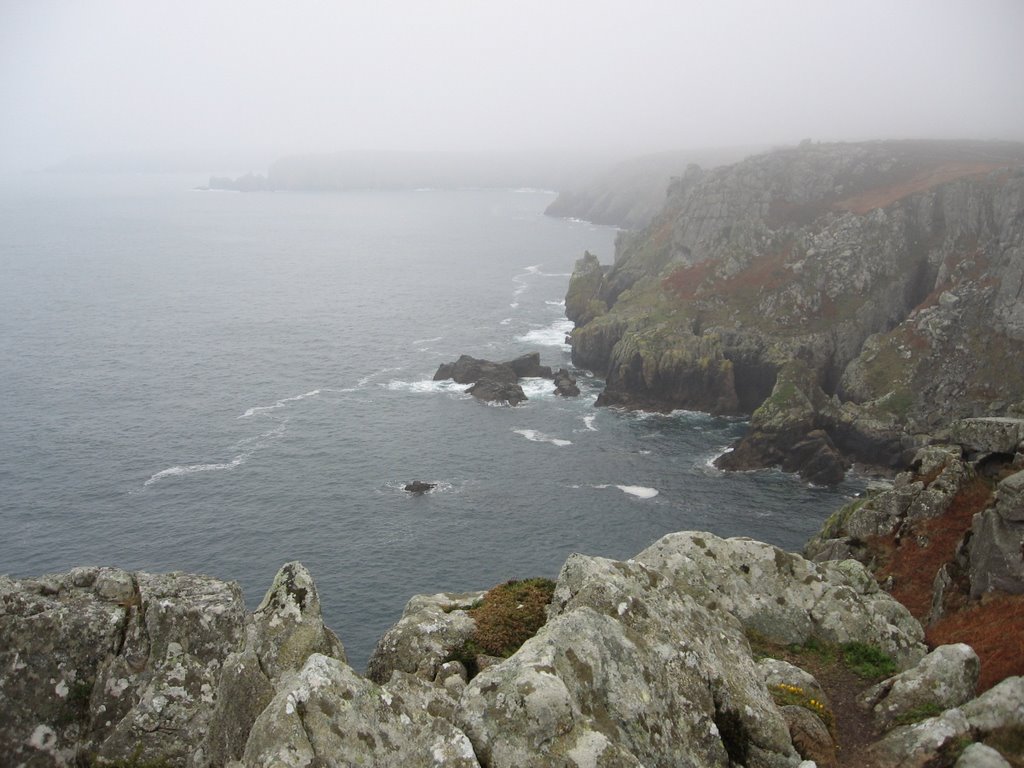
The scenery at the Pointe is quite spectacular with the granite cliffs dropping 230 feet sheer into the sea with gulls nesting on the abundance of barren rocks off shore. Really, the scenery and atmosphere at this far west tip could just as easily be around Cornwall's Land's End. Indeed, the next headland south, where we are camping tonight is even called Cornouaille!
 Pointe de Penhir
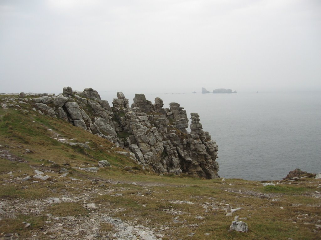 View from the Pointe de Penhir
At the Pointe de Penhir this morning there were the local pompiers or firemen out practicing cliff rescue and adding a touch of colour and excitement to the landscape. Here too, on these beautiful cliff-tops can be seen the remains of the bunkers, trenches and gun emplacements that formed part of the German defences during the Second World War known as the Atlantic Wall. Despite the best efforts of the natural elements and the advances of heather and gorse, apart from the guns having been removed and graffiti scrawled all over the inner walls, these defences remain as solid, ugly and massively overbearing as the day they were constructed. We were able to climb down into the trenches and even enter through a staircase at the rear of one of the bunkers, to emerge at the platform that formerly housed the massive gun, for a birds-eye view directly out over the headland and the sea.
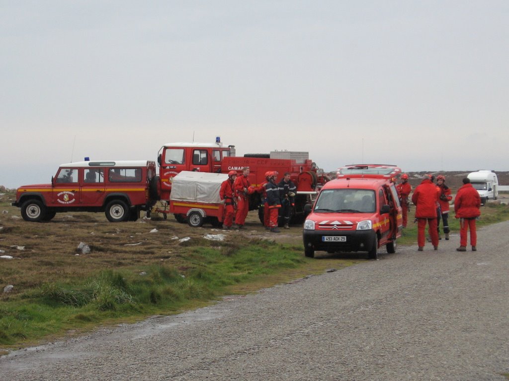 Firemen at the Pointe de Penhir
 View from the Pointe de Penhir with remains of a German bunker
Soaking wet by now we continued in Modestine along the cliff-top to seek out the alignments of Lagatjar consisting of 143 menhirs or standing stones, similar to but smaller than those at Carnac. They were apparently only discovered during the 20th century.
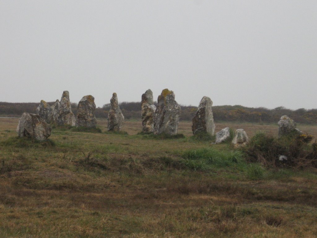 Alignements of Lagatjar
By now the rain had really set in but we continued hopefully to the Cap des Espagnols from were we should have had an excellent view across to Brest and its naval base but found it almost completely blotted out by mist.
There must be something to do somewhere on a wet peninsula! Remembering a monastery, rather like Buckfast Abbey, at Landevennec we headed off through the rain and the mist along lanes edged with sodden ferns and soaking cattle still patriotically chewing away to ensure Brittany's production of butter, cheese and cream is maintained. As we drove the road was suddenly closed-off ahead of us and we realised we had accidentally ended up at the gates of the nuclear-powered submarine base which, according to Danielle, is housed beneath the sea and deep inside the cliffs. There is no indication of what it actually is, just a barrier across the road and fencing all around. There is even a completely unmarked white patch on our Michelin map. Sizun or Sizewell, when it comes to nuclear fuel, Size matters!
Down at Landevennec, at the water's edge, sheltered from the force of the Atlantic, the climate is soft and mild, almost sub-tropical, with woodland, wayside flowers and bright camellia bushes. The abbey of St. Guenolé though, was closed against us and the rain was falling here as well.
After lunch in Modestine we tried in vain to phone some English friends who retired here some years ago to run a craft workshop near Carhaix. They seem to have been on their computer all morning. Very wise as they have now probably escaped unscathed as by tomorrow we will be too far away to drive back to visit them.
Our map showed us to be within striking distance of Douarnenez, twinned with Falmouth. It turned out to be a pleasant enough little town, rather run down today but with picturesque granite streets leading down to its harbour and quay. In earlier times the town was famed for its sardine industry, first salted and barrelled, and in later years, once canning factories arrived, preserved in oil and tinned. The town became the main fish canning factory of France processing millions of sardines annually to be sent throughout the world. Today the first factory still stands in a picturesque position on the island of Tristan just offshore. Within sight of it, on the mainland, stands one of the modern factories that long since replaced it.
 First fish factory on Tristan Island, Douarnenez
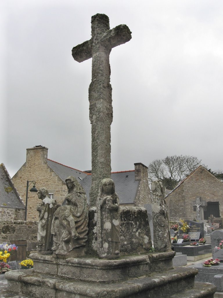
Still dripping with rain we headed towards the third of Brittany's western peninsulas, the one known as Cornouaille where we are now staying. We stopped to look at the delightfully carved 16th century granite church at Confort. Nearby there is a 16th century Calvary, though Jill was surprised to discover the figures on this had been recarved in the 19th century.
 Church and Calvary at Confort
At Pointe de Van we parked Modestine and walked across the cliffs, following a footpath to the cliff edge from where we didn't enjoy a spectacular view across the Crozon Peninsula to the Pointe St. Mathieu, though we are assured there is one when not blotted out by rain. We were able to take refuge for a few moments though in a delightful little chapel set amongst the thrift and the heather, with carved granite saints and a surprisingly ornate altar. From near here we could look down onto the Baie des Trepassés (Bay of the Dead), so called because of the bodies of mariners washed up on the shores of the bay. Just here the sea rushes through between the Pointe du Raz and the island of Sein a few miles off shore. Raz means a strip of water in Breton and this one is notoriously dangerous with submerged rocks and the jagged cliffs of the mainland.
 Pointe du Van
 Thrift on the cliffs at Pointe du Van
 View towards the Pointe du Raz across the Baie des Trepassés
By now it was time to start thinking about where we would spend the night in the ceaseless rain with our jackets soaked and our feet wet. Following a little lane through the green countryside we chanced on a farm offering rather basic camping facilities but it is a most beautiful setting. It's the cheapest we have found anywhere being 5 euros a night including electricity but not hot water. It is a very peaceful place to spend the evening with the rain on the roof, a glass of wine to hand, the blog to write and masses of lovely photos to select and sort.
Sunday 16th April 2006, Pointe de Penmarc'h, Brittany
It rained all night but today has just about managed to stay dry though far from cheerful. The air though is remarkably soft, clean and refreshing. It would have been nice to stay another day at such a pleasant location and walk along the cliffs to the Pointe du Raz but with such uncertain weather we decided to continue around the coast road, exploring various little villages on the way. The first of these was St Tugen with its huge granite tower and carved statues on the Calvary by the south door. Nearby was the little fontaine or holy well with its tiny statue of St. Tugen. Nearby too was the village baker, very busy this Easter Sunday. We joined the local people queuing for their strawberry gateaux, meringues, Breton butter cakes and pancakes. These we watched being made in the shop, deftly folded and packaged up by the dozen - strange in a country that uses metric! We bought croissants and a piece of Far Breton. This is a deliciously heavy, puddingy cake oozing in cholesterol, butter, eggs, sugar and dried plums and is a speciality of the region. (It's one of the few cakes Jill can cook having been taught by Danielle. Next time any of you visit us in Exeter, if you remind us, we'll make it for you.)
 Calvary at St. Tugen
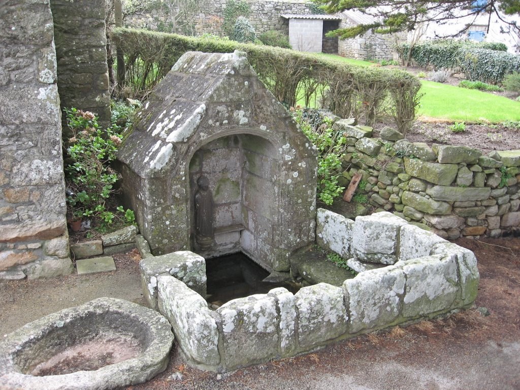 Holy well at St. Tugen
A few miles further on we stopped at the little fishing port of Audierne, busy with people out for an Easter morning stroll along the quay to see the fishing boats moored along side or to sit in the bars with their coffees and cider. There was an all pervading aroma of fish and large crates of fishing tackle, nets and marker buoys on the quayside ready to load down onto the boats.
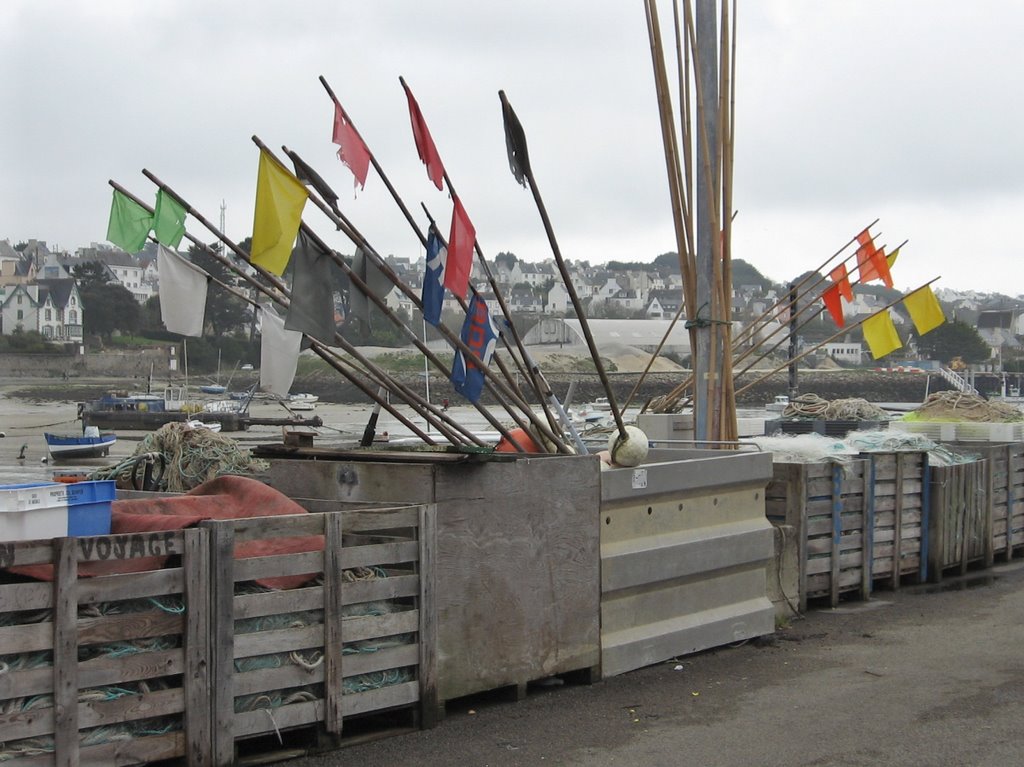 Marker flags and fishing nets, Audierne
It always takes us ages to get anywhere and today we have made really slow progress because we find everything so intriguing. At Pont-Croix we stopped for lunch by the tidal inlet upriver from Audierne. We then walked up the steep hill into the little town where we discovered its very attractive church with a typical granite clocher, carved figures and open tracery over the entrance. Inside it seemed huge for such a tiny town with beautiful, variegated rose granite columns, Romanesque arcades and painted barrel-vaulted roof.
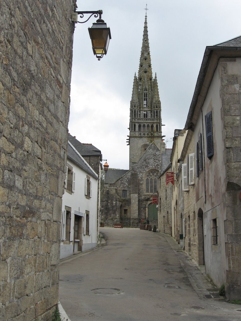 Spire of Notre-Dame-de-Roscudon, Pont-Croix
Used as a model for Quimper Cathedral
 Entrance to Notre-Dame-de-Roscudon, Pont-Croix
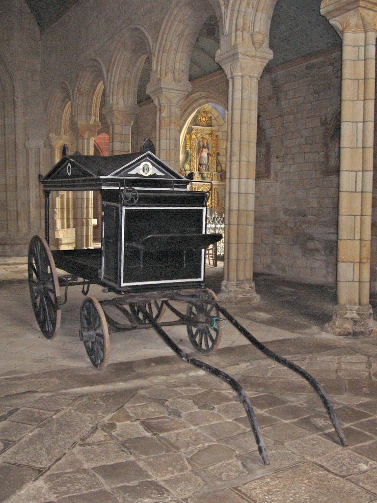 Horse-drawn hearse and arcade at Notre-Dame-de-Roscudon, Pont-Croix
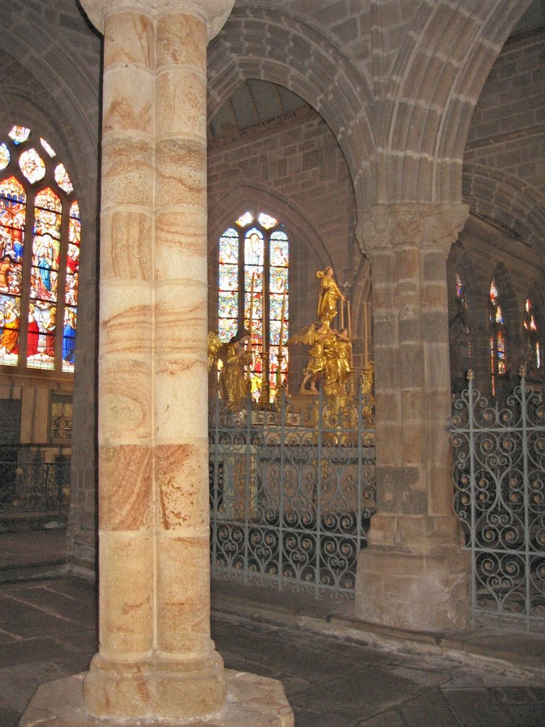 Variegated granite column at Notre-Dame-de-Roscudon, Pont-Croix
The now familiar sound of Breton bagpipes accompanied by a drum and a bombard (very noisy wind instrument) lead us to an open square where a mediaeval market was taking place and everyone was having an obviously happy time. There were exhibitions ranging from beekeeping, candle making, bookbinding, woodturning, shoemaking, jewellery, clothing, textiles, cakes, perfumes and ceramics. To tell the truth, not much of it looked mediaeval - except perhaps for lots of kids wearing cardboard crowns and carrying wooden swords - but having fun was what really mattered. We were all informed by the long-haired bombard player with his tabard, hose and home-made shoes with turned-up toes, that a brocante fair was taking place on the main square. This turned out to be a glorified car boot sale, very popular with the locals, where we bought a novel by Guy de Maupassant.
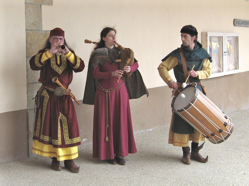 Mediaeval musicians, Pont-Croix
Steadily but slowly making our way southwards, we finally reached the Pointe de Penmarc'h at Brittany's furthest south west corner. Our route took us through acres of flat, sandy fields planted out with millions of tulips for the flower industry and forming a corduroy of brightly coloured stripes. The roadside and field edges were crowded with people photographing the flowers, an obviously popular Easter outing.
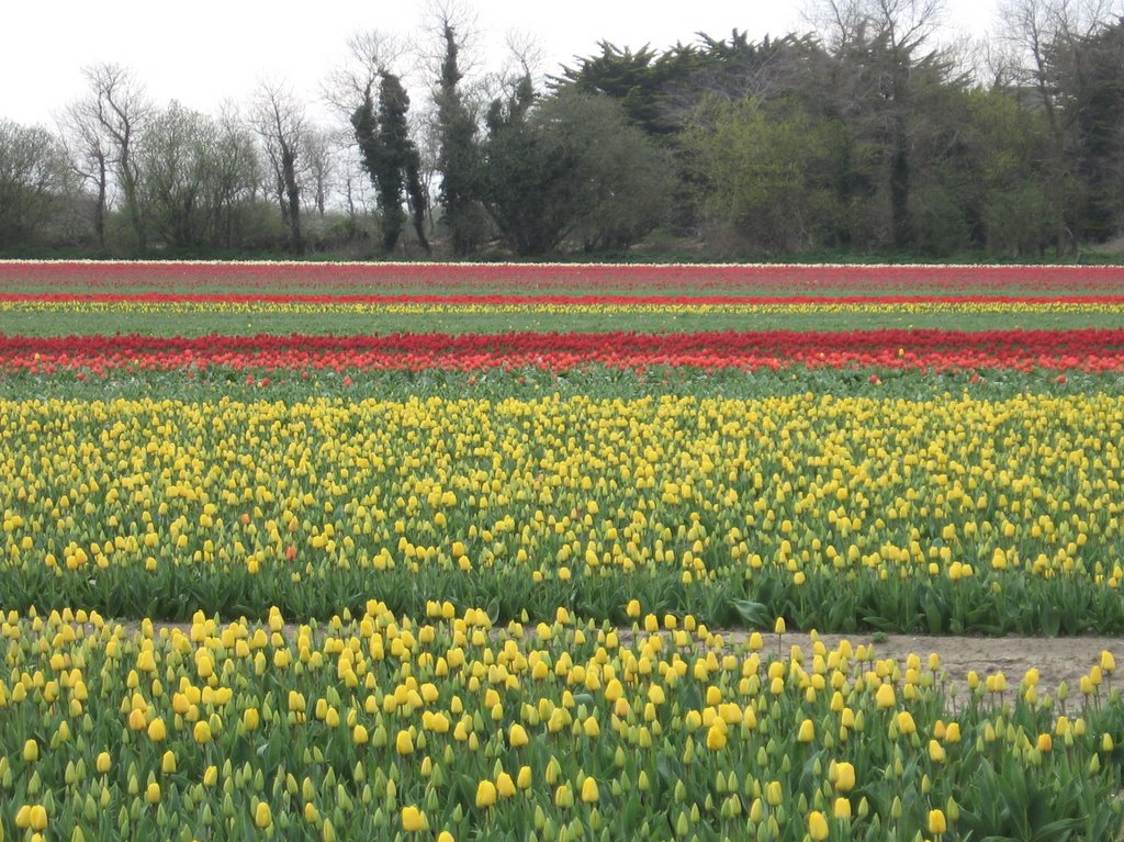 Tulip fields near Pointe de Penmarc'h
The little town at Pointe de Penmarc'h was also crowded with families and the beach, consisting entirely of tiny, brightly coloured shells, was being raided by children with small plastic buckets who found the bright yellows, oranges, greens, and rusts quite irresistible. Even Jill couldn't resist them and Ian had to force her to return them to the beach again!
There is a very solid, rather attractive lighthouse here at Penmarc'h, known as the Phare d'Eckmühl. Unfortunately it was just closing as we arrived. The coastline here is less rugged than on the Sizun Peninsula. There are still many dangerous rocks offshore but no cliffs, the coastal hinterland being flat and open - probably similar to the area of the tulip bulb fields in Holland.
 Lighthouses, chapel and signal station, Pointe de Penmarc'h
Monday 17th April 2006, La Trinité-sur-Mer, Brittany
Jill woke with an awful headache despite having slept well, and continued to feel weary and uninspired all day, so please excuse if this blog is not up to par.
We drove the short distance into Pont l'Abbé, a pleasant little granite town (as they all are) of around 8,000 people. It is the capital of the Bigouden region. We don't really know anything about the Bigoudens except that the ladies tend to wear a high lace head-dress for special occasions, saints' days and pardons. The museum, which might have enlightened us, was closed for lunch when we arrived. The town has a castle and stands on a tidal estuary. The delightful children's fiction character Bécassine and her adventures as a clumsy nanny comes from the Bigouden region. She is Brittany's answer to Mary Poppins. Her illustrated books are delightful. Now though, she has discovered a new niche with her image appearing on tourist souvenir products.
 Typical Bigouden lace head-dress, Pont l'Abbé
 Bécassine goes into marketing
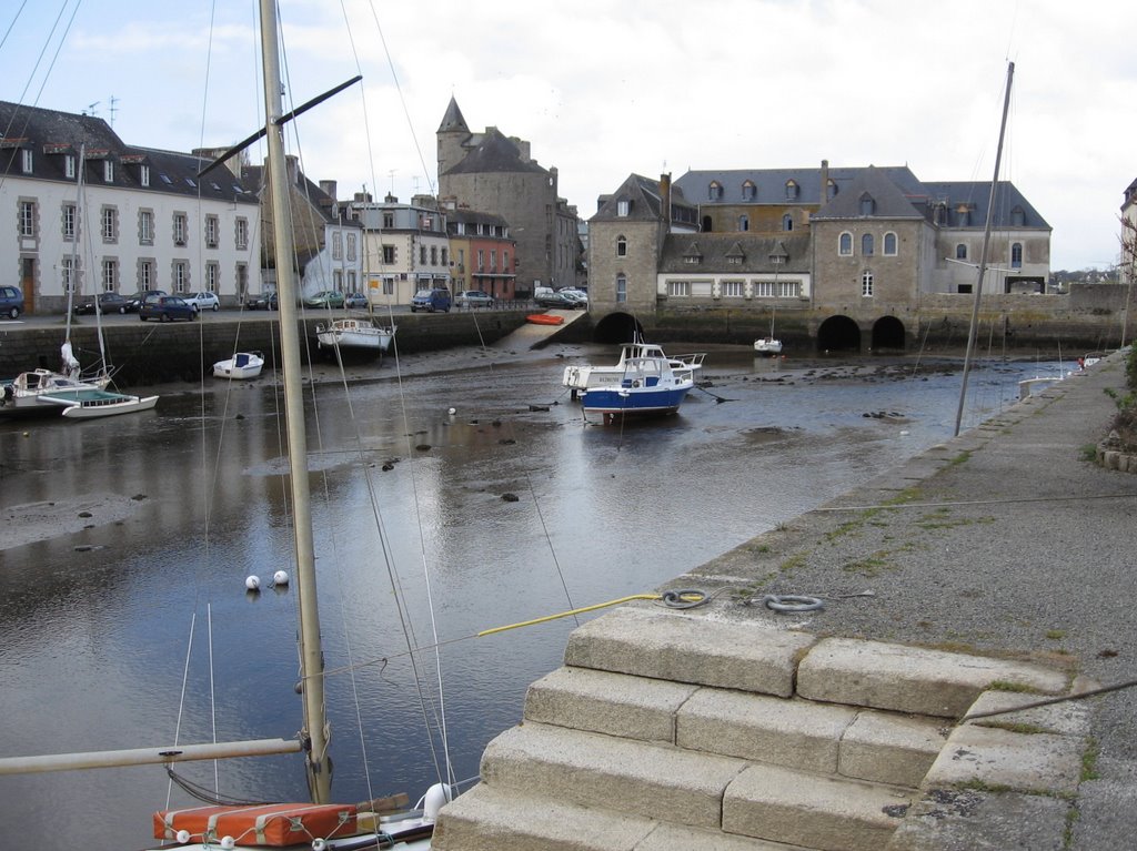 The port, Pont l'Abbé
 The castle, Pont l'Abbé
We continued down to the coast and the little town of Bénodet on the estuary of the Odet river. This looked a lovely little resort when we arrived with pretty houses, trees to the river bank, boats bobbing on the water and beaches of soft white sand. There is also an impressively grand lighthouse within the town, surrounded by green lawns and blooming camellia bushes. However, after a brisk walk along the seafront we discovered we had seen everything within a few seconds of arriving and it was actually rather a dull little place despite its beauty.
So we headed for the walled city of Quimper, capital of the Breton faience industry. Here the famous, immediately recognisable hand-painted plates, jugs and vases are produced, painted in bright blues, reds and yellows with images of Breton life or cockerels and other creatures. Parking beside the river within sight of the twin spires of the Cathedral, we gradually made our way through the streets of 16th century houses in pans de bois (half-timbering), slate-hanging or decorated granite, to the wide parvis in front of the cathedral. Here there is a statue to the doctor Laënnec, born in Quimper, famed as the inventor of the stethoscope. Inside, there is a kink in the nave caused by unexpected problems during construction. Not for us the pleasure of seeing around the interior today though. Hardly had we started to explore when we were ushered out as an Easter son et lumière event was about to take place. Pay up or leave. So we left.
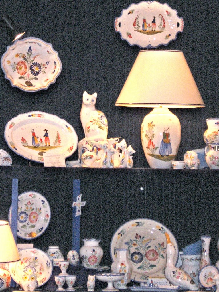 Display of Quimper ceramics
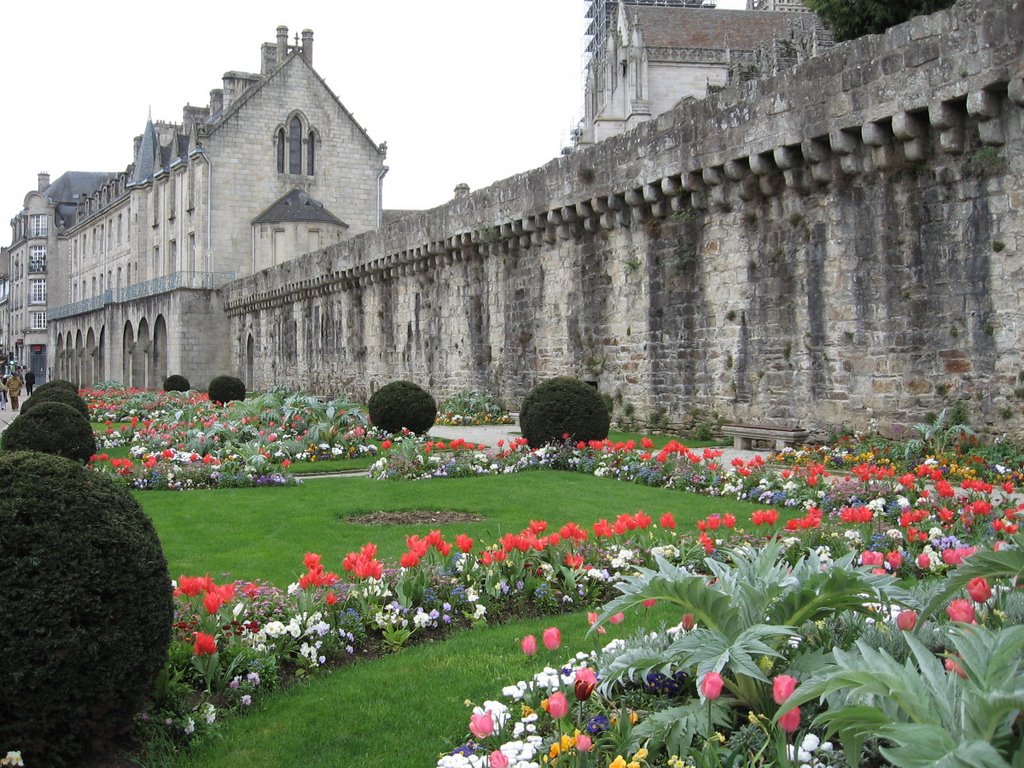 City walls, Quimper
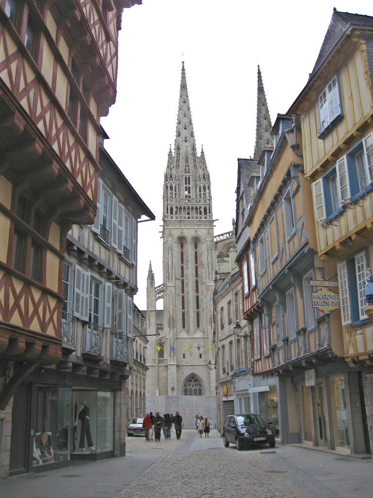 The approach to the cathedral, Quimper
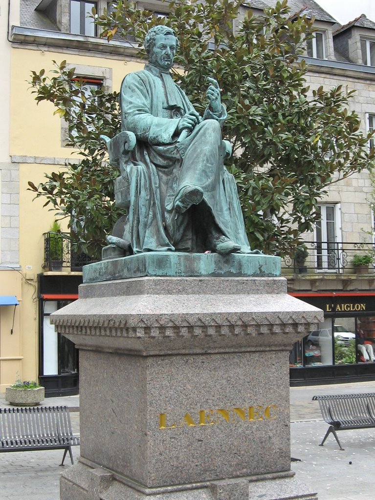 Dr Laënnec, inventor of the stethoscope, Quimper
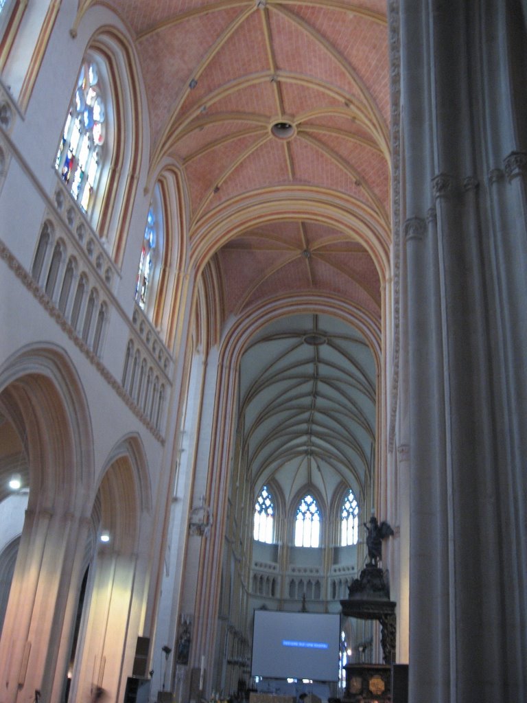 Interior of the cathedral showing the choir offset from the nave, Quimper
Having thoroughly explored the old quarter of the town we decided we still had rather a long way to go before we reached Venice and at this rate we wouldn't arrive until some time in 2009. There are some very pretty areas around the coast here, including the beautiful little resort of Pont Aven, famed for the brightly coloured paintings of artists such as Paul Gaugin, active here in the 1880s. As we have already visited Pont Aven as well as Concarneau and Lorient some years ago, we reluctantly decided to give them a miss and head straight for Carnac some 85 kilometres away.
Carnac is renowned for its several megalithic sites which together comprise over 3,000 standing stones or menhirs set in various alignments over an area of 4 square kilometres. There are also dolmens, cromlechs and tumuli. Several years ago when we visited we were able to wander freely between the stones but, as at Stonehenge, they have now been cordoned off with a pathway around the outside. None-the-less, they remain an awesome sight. Why are they there, and what was in the minds of the people who constructed them nearly 5,000 years ago? Nearby we discovered the remains of a huge stone circle or cromlech passing right through a tiny hamlet. Indeed the circle had simply been incorporated into the garden walls of the village!
 Remains of a Megalithic stone circle at Ménec, near Carnac
 Menhirs in the Ménec alignments, Carnac
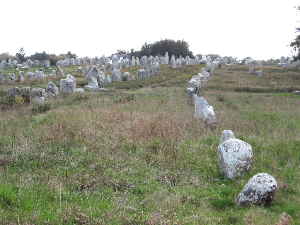 Kermario alignment of standing stones, Carnac
 Dolmen at Kermario alignments, Carnac
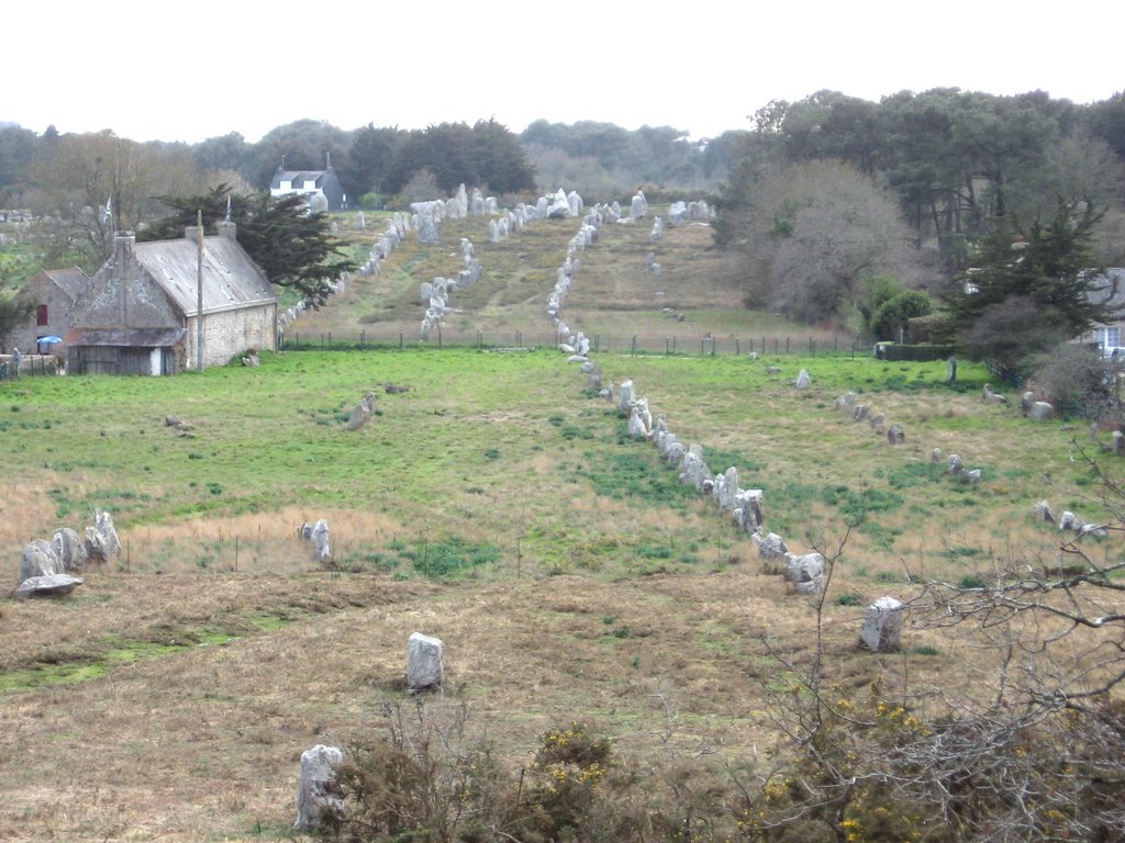 Kermario alignment stretching to the distance, Carnac
Around 7pm we decided we'd best find somewhere for the night. There are dozens of camping cars around during the day but most park up for the night on local beaches or in car parks. This is okay if there is enough room to move about inside your vehicle and if you have water and a loo. We have done this when absolutely necessary but prefer access to facilities and the security of a site. Usually we are the only ones around though now the days are longer and more sites are open, there are a few more people about.